The Grand Staircase Escalante…
Steps Through Geologic Time
The Golden Cathedral - Photo: Courtesy John Fowler
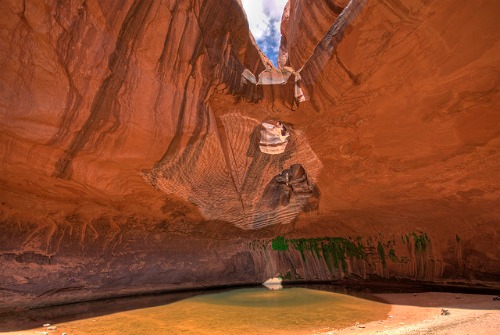
The Grand Staircase Escalante National Monument was established by President William J. Clinton on September 18, 1996 by Presidential Proclamation .
At that time, it was the nation’s second newest national monument and the second largest in the lower 48 states.
The monument encompasses an area of 1.7 million acres which is 3% of the land mass of Utah.
It extends eastward from Bryce Canyon National Park to Capitol Reef National Park and southward to Glen Canyon National Recreation Area.
Grand Staircase-Escalante National Monument (GSENM) can be divided into three distinct sections: the Grand Staircase, the Kaiparowits Plateau, and the Canyons of the Escalante River.
Grand Staircase Escalante is managed by the Bureau of Land Management (BLM)which is unique in the fact that it is the only national monument or park so managed.
“The Grand Staircase-Escalante National Monument's vast and austere landscape embraces a spectacular array of scientific and historic resources.
This high, rugged, and remote region, where bold plateaus and multi-hued cliffs run for distances that defy human perspective, was the last place in the continental United States to be mapped.
Even today, this unspoiled natural area remains a frontier, a quality that greatly enhances the monument's value for scientific study.
The monument has a long and dignified human history: it is a place where one can see how nature shapes human endeavors in the American West, where distance and aridity have been pitted against our dreams and courage.”1
Courtesy: Bureau of Land Management
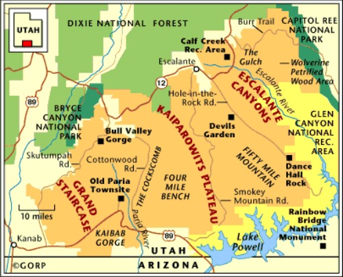
|
Location It extends eastward from Bryce Canyon National Park to Capitol Reef National Park and southward to Kanab and along the northern boundary of Glen Canyon National Recreation Area. |
Books and Maps about the Grand Staircase Escalante National Monument may be purchased at the various Visitor Centers, or you may purchase them at Amazon.com by clicking the link below. |
Getting There
Grand Staircase Escalante National Monument is a 1.7 million acre remote wilderness and therein lays its attraction.
There are only two paved roads into the Grand Staircase Escalante National Monument: Scenic Byway 12, which runs east and west across the northern portion and Highway 89, which crosses a small portion of the southern boundary.
All other roads are unpaved and often very primitive.
Operating Hours and Seasons
Grand Staircase Escalante National Monument is open year-round, 24/7.
Entrance Fees
There are no entrance fees to the monument.
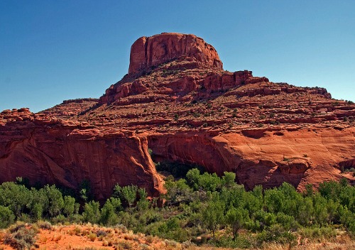
Entrance to Neon Canyon - Photo: John Fowler
Visitor Centers
The Bureau of Land Management manages the Grand Staircase Escalante National Monument. On their website, they list six visitor centers for the monument.
Lodging
Although there is no Grand Staircase Escalante Lodge, it is possible to find lodging located within the Monument or just outside of it.
The following are the towns along Scenic Byway 12, or very nearby, which have lodging.
• Boulder
• Bryce Canyon
• Cannonville
• Escalante
• Hatch
• Panguitch
• Torrey
• Tropic
Kanab, Utah and Page, Arizona are located near the bottom of the Monument on Hwy 89.
|
The easiest way to find lodging in any of these locations is to use the search box on the right. Simply fill in the location and the dates, and let Hotels Combined find you the best prices. This is not a booking agency. It is a search engine, powered by Hotels Combined, to help you find the best prices for the dates you need. |
Overnight Permits
Overnight permits are required within the Monument for all overnight car-camping or backpacking.
Permits are free of charge and may be obtained at any visitor center or at developed trailheads.
|
Broken Bow Arch - Photo: Courtesy John Fowler 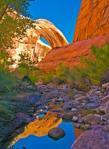 |
Campground Fee Areas The only two developed campgrounds managed by the BLM in the Escalante- Boulder area are Calf Creek 15 miles east of Escalante and Deer Creek, 6 miles southeast of Boulder. Calf Creek - $7.00 per night. Deer Creek - $4.00 per night. There are currently just two developed campgrounds managed by the BLM Kanab Field Office -- the Ponderosa Grove Campground located near the Coral Pink Sand Dunes State Park, and the White House Campground near the Paria Canyon-Vermilion Cliffs Wilderness Area. White House - $5.00 per night. Ponderosa Grove - $5.00 per night.
|
Other Campgrounds
There are several other developed campgrounds in or near the Grand Staircase Escalante National Monument that are managed by either the United States Forest Service or the state of Utah.
For a list of these campgrounds and information about them, Click Here.
Day Use Fee Areas
Calf Creek Recreation Area - $2.00
Pets
If you bring your dogs to GSENM please observe the following rules:
Dogs must be leashed on the Lower Calf Creek Falls Trail and within Glen Canyon National Recreation Area.
Dogs are banned from Coyote Gulch as of April 2005.
|
Weather and Climate The climate in Grand Staircase-Escalante is temperate and arid, with annual precipitation averaging about 10 inches. From June through early September thunderstorms advance from the Pacific Ocean off the coast of Mexico and southern California. Frontal-type storms out of the northwest move through the area from October through June. The highest amount of precipitation occurs from November through March. Summer temperatures vary approximately 30 degrees F., with highs in the mid to upper 90s and lows in the mid 60s. Winters in Escalante have a temperature range of about 26 degrees F., with highs in the low 40s and lows of about 15 degrees F. Snowfall in the Monument generally averages 28 inches, beginning in October or November and ending in March or April. |
Neon Canyon - Photo: John Fowler 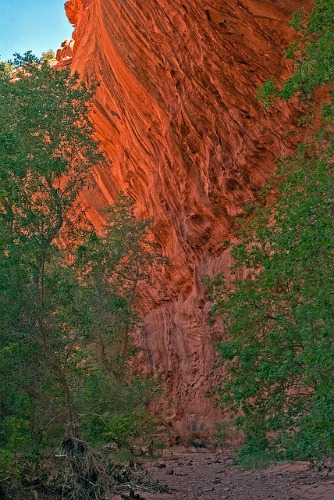 |
Weather conditions and water temperatures are generally most favorable during this period.
It is impossible to predict weather conditions in the Grand Staircase-Escalante National Monument area very far in advance.
Best Time To Visit
The best time to visit the Monument is late March through June and early September through October.
Nearby Attractions
While you are in the area, be sure to visit some or all of the nearby attractions:
• Bryce Canyon National Park
• Calf Creek Falls
• Capitol Reef National Park
• Cedar Breaks National Monument
• Coral Pink Sand Dunes State Park
• Lake Powell
• Rainbow Bridge National Monument
• Zion National Park
Have A Great Story To Share?
Do you have a great story about this destination? Share it!
Getting Around The Park
There are only two paved roads into the Grand Staircase Escalante National Monument: Scenic Byway 12, which runs east and west across the northern portion, and Highway 89, which crosses a small portion of the southern boundary.
All interior roads except for portions of the Burr Trail and Johnson Canyon Road are unpaved, often very primitive and may be impassible if wet.
Much of the backcountry can be traveled in a 2-wd vehicle, but there are many roads which need a high-clearance 4-WD vehicle. The trick is to know the difference.
When the roads are wet, they are often impassable, even with 4-WD vehicles. Always err on the side of caution.
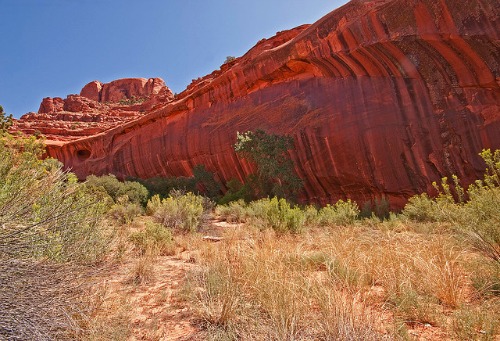
Neon Canyon - Photo: Courtesy John Fowler
Things to Do
Scenic Byway 12
The 25 mile stretch of Highway 550 between Silverton and Ouray, Colorado, is known as the million dollar highway, a testimony to its scenic beauty.
In Utah, the 124 mile stretch of the Scenic Byway 12 between Bryce Canyon and Capital Reef is, also, called the million dollar highway, with scenery that is arguably more beautiful than that in Colorado.
“Scenic Byway 12 spans a route of 124 miles, and travels through some of the most diverse, remote and ruggedly beautiful landscapes in the country. It runs through Utah’s Garfield and Wayne Counties and is home to two national parks, three state parks, a national recreation area, a national monument, and a national forest.” 2
If you do nothing more at the Grand Staircase, treat yourself to this drive.
|
Photo: Courtesy BLM 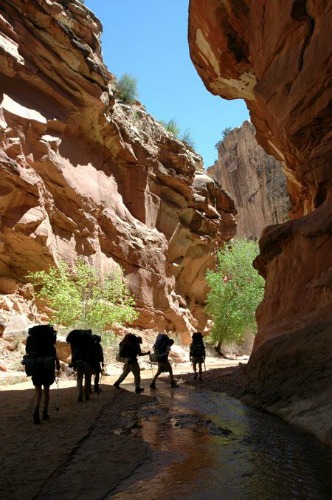 |
Hiking To really see GSENM it is necessary to get off the beaten path and venture in the backcountry. A world of narrows and slot canyons, arches, deep alcoves, petrified sand dunes, lush vegetation and hanging gardens and vast panoramic vistas. Grand Staircase Escalante National Monument offers some of the best canyon hiking in the southwest, but there is a caveat. The following is what the BLM has to say about hiking in the Grand Staircase Escalante: “Almost all hiking is on unmarked routes where the use of a map, compass, and/or a GPS unit is necessary. The terrain is rugged. River travel involves numerous water crossings or walking in water for long distances and bushwacking through dense brush. |
Side canyons and slots can have deep pools of cold water even in the summer months. Flash floods can occur any time of the year. Quicksand is common and may be waist-deep in places.”
Now that I have thoroughly discouraged you, let me say that there are some easy day hikes within the monument, and you definitely should consider some of them.
For further information on hiking within the Grand Staircase Escalante. Click Here.
Biking
Although there are no trails specifically designated as biking routes within the monument, the BLM has listed nine routes which would be suitable for mountain bikes. There are three in each of the districts, Grand Staircase, Kaiparowits Plateau and Escalante Canyons.
For more information on biking within the Grand Staircase Escalante, Click Here.
Sidebar
Mountain biking is not allowed on backcountry hiking routes.
All vehicles and bicycles must stay on roads.
Driving off road is prohibited. 43CFR 8341.1 (c)
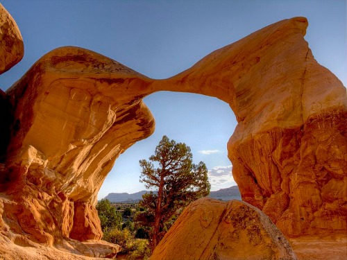
Metate Arch - Photo: John Fowler
Off-Highway Vehicles
There are over 900 miles of routes available for vehicle travel. However, off-highway vehicles (OHVs) are restricted to certain designated roads in the Monument.
For a list of those routes, Click Here.
Controversy
The Kaiparowits Plateau contains the largest deposit of compliance coal in the United States.
Compliance Coal means coal which, when burned, emits less than 1.2 pounds of sulfur dioxide per million Btus. Compliance coal meets sulfur emission standards imposed by Title IV of the Clean Air Act.
In the 1960s, a consortium of Arizona and southern California utility companies set plans into motion to build four open pit coal mines and a coal-burning power plant on the Kaiparowits.
In the 1960s, a consortium of Arizona and southern California utility companies made plans to build a coal-burning power plant and four open-pit coal mines on the Kaiparowits.
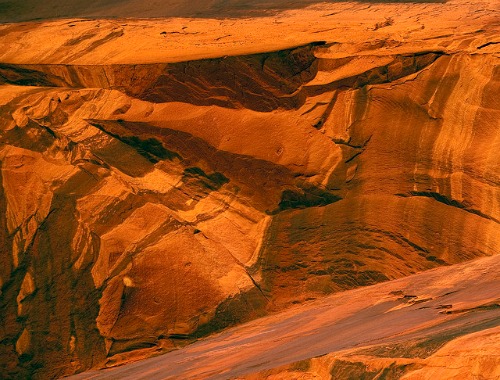
Photo: Courtesy John Fowler
The project would create eight to ten thousand jobs and bring millions of dollars into the local and state economy.
However, many of the area residents and environmental groups like the Sierra Club, the Wilderness Society and the Audubon Society were strenuously opposed, arguing that the impact on the environment would be overwhelmingly destructive.
In 1976, after years of very contentious debate, the project was dropped; the public and the environmentalists had won.
But, this was not to be the end of it. In 1991, Andalex Resources, Inc., a Dutch-owned company, requested permission from the state of Utah to develop an underground mine on 10,000 acres of leased land in the Kaiparowits.
Again, there was opposition from area residents and national environmental groups, even to the filing of a lawsuit by the Southern Utah Wilderness Alliance against the Utah Division of Oil, Gas & Mining.
The battle waged on until September of 1976, when President William J. Clinton signed the proclamation establishing the Grand Staircase Escalante National Monument.
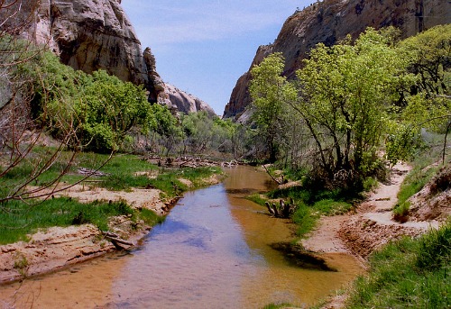
Calf Creek - Photo: Wikimedia Commons - Nikater
Here, again, the controversy did not end.
“…the drafting of the proclamation was not disclosed to state and local governing officials and the public at large. No one outside of a secret Department of Interior counsel, including even the governor of Utah, was informed of the impending action until it was reported in several newspapers just days before the public announcement.”3
While this action was legal under the Antiquities Act of 1906, which does not require any public disclosure, a lot of people were justifiably upset.
“Although the proclamation did not necessarily prohibit development of existing mining leases per se, the implementation of the required roads, power lines, and other infrastructural needs were very much at odds with the monument's stated purpose of preserving this "unspoiled natural area."4
For anyone interested in reading more about the geology, history and mining controversy of the Grand Staircase Escalante, I strongly recommend Land Use History of North America Colorado Plateau, referenced below.
|
References and Resources 1 September 18, 1996 2 A Route Guide To Scenic Byway 12 3 Land Use History of North America Colorado Plateau 4 Ibid., p. 3. |
Photo: Wikimedia Commons - Ciar 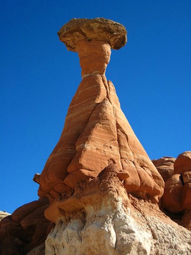 |
Return From Grand Staircase Escalante To Nearby Attractions
Return To Lake Powell Country And The Grand Circle Home Page

