Capitol Reef National Park…
A Complete Guide
Capitol Reef National Park, located in south-central Utah halfway between Bryce Canyon and Canyonlands National Parks, is 378 square miles of magnificent, stratified rock formations freely sprinkled with a host of desert plants and animals.
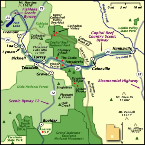
Highway 24 bisects the Park near its northern boundary and runs east to west paralleling the Fremont River, named after explorer John C. Fremont who crossed its headwaters in 1853.
Capitol Reef National Park - Courtesy National Park Service
Location
Capitol Reef National Park is located in south-central Utah, off Hwy 24, half way between the towns of Torrey and Hanksville.
Park Fees
Entrance Fees, good for 7 days, are charged for traveling the park's Scenic Drive beyond the Fruita Campground.
Individuals: $3.00 – This fee applies to pedestrians and bicycles (per person).
Vehicles: $5.00 – This fee applies to private vehicles and motorcycles.
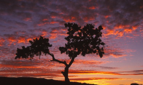
Sunset at Panorama Point
Capitol Reef National Park
Seasons and Hours
The Park and Campground is open all year round.
The visitor center is open daily from 8:00 a.m. to 4:30 p.m. during the winter, 8:00 am to 5:00 pm in spring and autumn and 8:00 am to 6:00 pm in the summer.
Holiday Closures
The visitor center will be closed for the following Federal Holidays during the year 2013:
Tuesday, January 1 New Year's Day
Monday, January 21* Birthday of Martin Luther King, Jr. and Inauguration Day
Monday, February 18** Washington's Birthday
Monday, May 27 Memorial Day
Thursday, July 4 Independence Day
Monday, September 2 Labor Day
Monday, October 14 Columbus Day
Monday, November 11 Veterans Day
Thursday, November 28 Thanksgiving Day
Wednesday, December 25 Christmas Day
|
Lodging |
This is not a booking agency. It is a search engine to help you find great lodging at great prices.
Have A Great Story To Share?
Do you have a great story about this destination? Share it!
Weather and Climate
Capitol Reef National Park has an arid climate with precipitation averaging just 7.2 inches (18.3 cm) annually at the park Visitor Center weather station.
The chart below, downloaded from the NPS website, is based on temperature and precipitation records from 1948 through 1986.
While it is somewhat old, it may give you an idea of what can be expected from the weather:
TEMPERATURES (F)
AVERAGE RECORDED PRECIPITATION (in.) SNOWFALL (in.)
MONTH HIGH LOW HIGH LOW AVERAGE RANGE RANGE CHANCE
JANUARY 41 18 69 -9 0.34 0 - 2.00 0 - 12.50 97%
FEBRUARY 48 24 72 -7 0.23 0 - 1.13 0 - 10.00 62%
MARCH 56 30 79 10 0.52 0 - 2.25 0 - 14.00 71%
APRIL 66 38 90 18 0.48 0 - 2.84 0 - 6.50 37%
MAY 76 47 95 28 0.65 0 - 2.23 0 - 2.50 3%
JUNE 87 55 104 36 0.45 0 - 2.29 - -
JULY 92 62 104 44 1.04 .90 - 3.13 - -
AUGUST 89 61 102 42 1.16 .04 - 4.42 - -
SEPTEMBER 81 53 98 30 0.72 0 - 3.00 - -
OCTOBER 68 42 91 17 0.79 0 - 3.33 0 - 10.10 13%
NOVEMBER 53 30 77 5 0.54 0 - 2.84 0 - 13.00 50%
DECEMBER 42 21 69 -8 0.29 0 - 1.49 0 - 8.00 90%
Accessibility
Capitol Reef National Park Visitor Center
The visitor center is accessible to wheelchair users and provides a ramped entrance, reserved parking, and accessible restrooms.
The 18-minute orientation movie is accessible and closed captioned for those with hearing impairments.
Trails
The petroglyphs along Utah Highway 24 are accessible by boardwalk.
The Petroglyph Panel, Fruita Schoolhouse, and Merin-Smith Implement Shed are accessible and feature audio guides.
Ranger Programs
Programs held at the Fruita Campground Amphitheater are accessible by a paved, lighted path from reserved parking spaces in the parking lot.
Programs held at the visitor center, Ripple Rock Nature Center, Petroglyph Panel are accessible to wheelchair users.
Campgrounds
The Fruita Campground is located south of the Visitor Center in the Fruita Historic District.
Sites at the Fruita Campground are $10 per night. Senior and Access pass holders receive a 50% discount on their campsite.
All sites, including five wheelchair accessible sites, are first come, first serve, with the exception of the Group Campsite.
If the campground is full, there may not be any wheelchair accessible sites available.
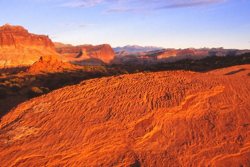
Panorama Point
Capitol Reef National Park
Things to Do
Fishing in the Fremont River (Utah fishing license required).
Pictographs and Petroglyphs - Very impressive petroglyph figures can be seen along a sheer cliff that parallels Hwy 24 just east of the Visitor Center in Capitol Reef.
The figures cover several rock panels and the diversity of images is astonishing. A road sign identifies the area, which includes a parking turnout.
Boardwalks and viewing platforms have been established to make it easy for visitors to see the figures.
Photography
Scenic Drives – With the exception of the 8.2 mile scenic drive which starts at the Visitor Center, the drives are all on dirt roads requiring a high-clearance/4WD vehicle. For more information, Click Here.
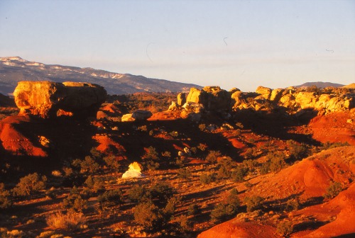
Jumbled Rocks
Wildlife Viewing
Biking (restricted to maintained roads open to vehicular traffic).
Free Ranger Programs offered from May to September
Rock Climbing – For more information, Click Here.
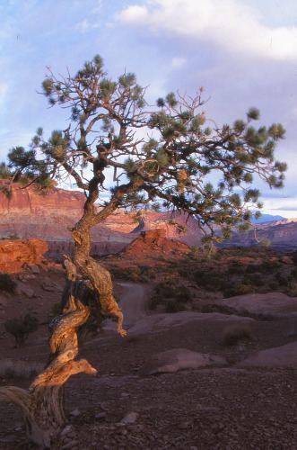 |
Day Hiking Backcountry Hiking |
For more information on backcountry hikes, Click Here.
|
Pets Pets are allowed: |
 |
Sidebar
Pets must be restrained at all times on a leash 6 feet (1.8 m) or less in length.
They may not be allowed to run free.
They may not be left unattended in vehicles, at trail head, campsites or any other location.
You are responsible for cleaning up after your dog and disposing waste in a dumpster.
Flora and Fauna
Mammals
One of the nice things about visiting a National Park is being able to watch animals in their natural environment.
Some of the mammals found in Capitol Reef National Park may be abundant and seen in large numbers in suitable habitat, while others are rare and seldom observed.
|
A few of the more common mammals are: • Desert Bighorn Sheep |
Mule Deer 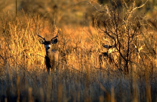 |
Birds
More than 230 bird species have been documented in Capitol Reef National Park. Some species are seasonal residents, others pass through during migration, and a few make this their home year-round.
|
A few of the more abundant birds found here are: |
Chukar 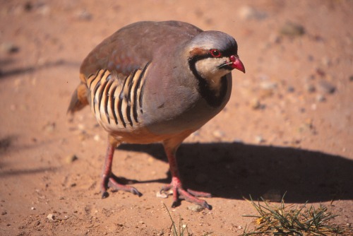 |
Reptiles
Many people, myself included, have an aversion to reptiles. They are, however, a necessary part of our ecosystem.
Some of the more common reptiles found in Capitol Reef National Park are:
• Gopher Snake
• Striped Whipsnake
• Terrestrial Garter Snake
• Midget Faded Rattlesnake
Flora
“The varied topography, geology, elevations, and precipitation patterns along the Waterpocket Fold have resulted in a diversity of microhabitats and niches for plant species to inhabit.”
|
Trees |
Cottonwood 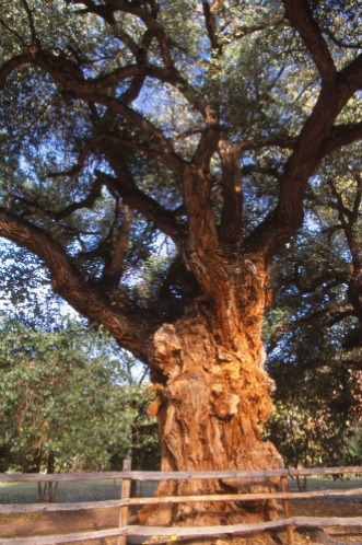 |
|
Cliff Rose 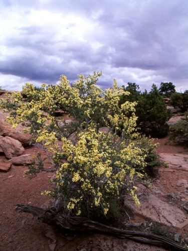 |
Shrubs |
|
Wildflowers Cacti |
Indian Paintbrush 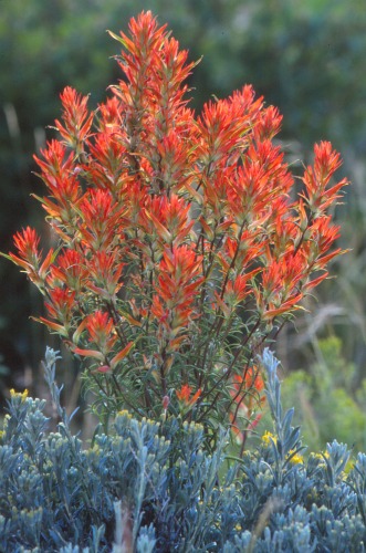 |
Claret Cup
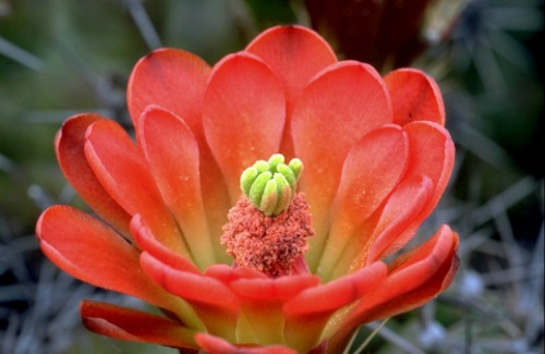
History
Fremont People (700 to 1300 AD)
Some of the earliest people to inhabit the area in and around Capitol Reef were the Fremont people named by archaeologists for the Fremont River which flowed east to west through the area.
They were primarily hunters and gatherers who supplemented their diets with maize, beans and squash grown in the bottomlands along the Fremont.
Unlike the Ancestral Puebloans who lived in rock buildings constructed above ground, the Fremont people lived in brush and log huts, called wikiups, pit houses dug into the ground and covered with a brush roof, or in natural rock shelters.
They built stone granaries in caves and alcoves to store maize and other crops.
Unique to the Fremont people was a leather moccasin made from the hide of large animals, such as deer, which incorporated the dew-claw as part of the sole.
Also, unique to the Fremont was a type of basketry, called one-rod-and-bundle, composed of willow, yucca, milkweed and other native fibers.
The area in and around Capitol Reef National Park abounds with rock art left by the Fremont people.
There are both pictographs (painted) and petroglyphs (pecked or carved) which depict people, animals and other shapes and forms.
The Fremont people left the area near the end of the thirteenth century probably as a result of an extended drought, overuse of local resources and the encroachment of the Shoshonean culture.
|
Historic School House 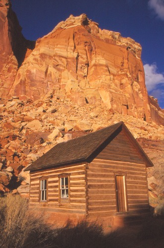 |
Mormon Settlers (1880s) Gradually, over the next 10 to 15 years, Mormon pioneers had established settlements throughout most of the arable land around Salt Lake City, avoiding the high plateaus and deserts to the southeast. |
|
Fruita, Utah |
Orchard 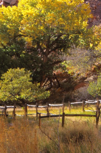 |
Fathers of Capitol Reef National Park
Two men deserve credit for the preliminary work that led to the creation of Capitol Reef National Monument (later Park)--Ephraim P. Pectol and Joseph S. Hickman.
Although Pectol has been called the father of Capitol Reef National Park, the two men worked together to promote the scenic value of what they then called Wayne Wonderland, a reference to its location in Wayne County, Utah.
It was largely through their efforts that the people of Utah were made aware of this beautiful and stunning wonderland.
Together they worked to organize local booster clubs to promote Wayne Wonderland and make it Utah’s first State Park.
In July of 1925 Joseph Hickman drowned at Fish Lake, and, after his death, the movement lost some of its momentum.
However, Pectol continued in his efforts to promote Wayne Wonderland, and in 1933 was elected president of the Associated Civics Club of Southern Utah.
That same year he was elected to the Utah State Legislature and one of his first actions was to contact President Franklin D. Roosevelt asking him for the creation of "Wayne Wonderland National Monument.
This resulted in a Federal feasibility study and boundary assessment under the supervision of Zion Superintendent Preston Patraw with Ephraim P. Pectol often acting as a guide.
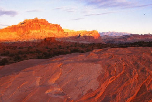
Panorama Point
National Monument Status
During this study, it was decided that a name change was in order, because “….neither "Wayne" nor "Wonderland" were "sufficiently distinctive" to describe the proposed area.
Since "Waterpocket Fold National Monument" was too long, Patraw suggested "Capitol Reef," the local name for the prominent domes and cliffs that would be at the center of the new monument.”
Finally, on August 2, 1937 President Franklin D. Roosevelt signed a proclamation making Capitol Reef a National Monument.
“Capitol Reef National Monument would be 37,060 acres, approximately 58 square miles.
Its dimensions were about 18 miles from the northwest tip to the southeast corner. It was roughly two to five miles wide.”
In 1942, Wallace Stegner, noted author and wilderness advocate, described the country as “…spectacular and almost inaccessible….The terrain is so broken and eroded that even yet parts of the monument have not been explored.”
|
Cottonwood with Sunburst 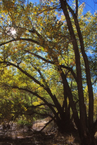 |
Unfortunately, due to a lack of funds needed for its development and operation, the Monument was not officially opened to the public until 1950. |
|
National Park Status |
Finally, after 37 years of often bitter and caustic wrangling and hassling, Congress gave Capitol Reef national park status on December 18, 1971.
Capitol Reef National Park References and Resources
Utah.com
http://www.utah.com/nationalparks/capitol_reef/petroglyphs.htm
National Park Service
http://www.nps.gov/history/history/online_books/care/adhi/adhi4.htm
http://www.nps.gov/care/planyourvisit/index.htm
National Park.com
http://www.capitol.reef.national-park.com/visit.htm#pets
Utah History to Go
The Fathers of Capitol Reef National Park
Charles Kelly
History Blazer, September 1995
http://historytogo.utah.gov/utah_chapters/from_war_to_war/thefathersofcapitolreefnationalpark.html
Return From Capitol Reef National Park To Nearby Attractions
Return To Lake Powell Country and The Grand Circle Home Page

