Newspaper Rock…
Read All About It
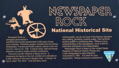
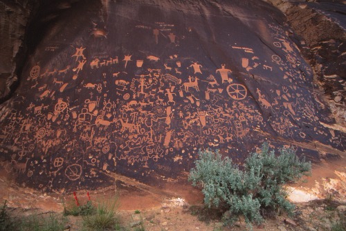
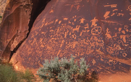
Newspaper Rock, located along Indian Creek in southeastern Utah, is a 200 square foot sandstone rock which was used as a canvas by ancient rock artists.
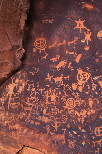
It is believed that the petroglyphs found here were made by various cultures over the last several hundred years.
The oldest culture reflected here were the ancestral Puebloans, followed by the Fremont people and then the Utes and Paiutes.
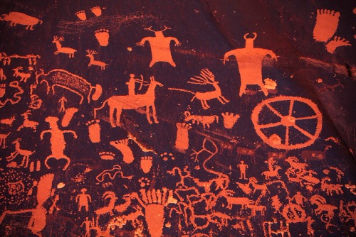
There are more than 200 petroglyphs at Newspaper Rock, and it is one of the largest, best preserved and easiest accessed group of petroglyphs in Utah.
|
This day-use site has toilet facilities and plenty of paved parking. Weather To Check on Current Weather in Moab, Utah, Click Here. |
To Find Books From Amazon.com About Petroglyphs, Click on the Link Below. Have A Great Story To Share?Do you have a great story about this destination? Share it! |
|
Lodging |
Simply enter the location and dates you have in mind, and the server, Hotels Combined, will provide you with a list of the lodging available on the dates you have specified.
This is not a booking agency. It is a search engine to help you find great lodging at great prices.
Camping
There is no camping at the monument.
The old campground was closed in 2006 and it is illegal to camp there.
Squaw Flat Campground
Squaw Flat Campground is operated by the Needles District of nearby Canyonlands National Park.
Squaw Flat is located approximately 25 miles northwest of Newspaper Rock and is reached by continuing on Hwy 211 from Newspaper Rock.
There are 26 sites available on a first-come, first-served basis.
Maximum RV length is 28 feet.
Facilities Include
• Restroom
• Tent pads
• Picnic tables
• Fire grates
• Water available year-round
Fee
$15 per night
Sidebar
Squaw Flat typically fills every day from late March through June and again from early September to mid-October.
Group size limit is 10 people and 2 vehicles.
Definition of Terms
Many people new to Lake Powell Country and the Grand Circle have difficulty understanding some of the designations used in describing this ancient rock art.
Here are some of the more common ones and their definitions:
Petroglyphs
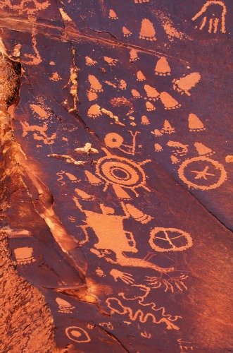
These ancient artists carved, chiseled, etched or pecked into the rock a variety of designs and symbols: animal, human, celestial and abstract.
Archaeologists call them petroglyphs.
They were most likely pecked or chiseled by using two handheld rocks, one used as a hammer and the other as a chisel.
Pictographs
Pictographs, on the other hand, are images and designs painted on a rock surface.
The paints were made from colorful plants and minerals which were ground up and mixed with liquids such as egg, blood or urine.
The pigments were applied using sticks, yucca fiber brushes or simply the artist’s fingers or hands.
|
These clay particles are attached to rock surfaces by bacteria that live there. |
 |
Repatination
“Repatination refers to the re-coloration, or the re-growth of the desert varnish after a petroglyph image has been created.
Repatination
occurs at various rates and degrees. A close examination of the degree
of repatination can give a relative idea of how old an image may be. A
great degree of repatination (darkening) indicates greater age than an
image that shows only slight repatination.” 1
|
General Information |
 |
How are petroglyphs dated? |
References and Resources
The American Southwest
Newspaper Rock State Historical Monument
http://www.americansouthwest.net/utah/canyonlands/newspaper-rock.html
Bureau Of Land Management (BLM)
http://www.blm.gov/ut/st/en/prog/more/cultural/archaeology/rock_art.html
1 National Park Service
http://www.nps.gov/petr/planyourvisit/def.htm
Utah.com
http://www.utah.com/playgrounds/canyon_rims.htm
Wikipedia
The Free Encyclopedia
http://en.wikipedia.org/wiki/Newspaper_Rock_State_Historic_Monument
Return From Newspaper Rock State Historical Monument To Nearby Attractions
Return To Lake Powell Country and The Grand Circle Home Page

